Roads, Peaks, and Stars: A Spontaneous Weekend Exploring the Blue Ridge Parkway
Milky Way Photography, Mountain Peaks, and the Beauty of Late Summer
August 31, 2019 was the day after a new moon. The weather forecast called for clear skies, and I set my sights on the mountains of Western North Carolina to try my hand at photographing the Milky Way in the night sky.
This trip was spontaneous, like many of my road trip adventures, but I knew I wanted to head to the Blue Ridge Parkway* to find a viewpoint for my attempt at astrophotography. Over the years, I have been lucky enough to have lived close enough to the parkway that I could escape for a scenic drive through the picturesque Appalachian Mountains. The average elevation of the parkway is probably around 3500 feet (1060 meters) and seemingly around every curve, there is yet another stunning view. I’ve visited the parkway in all weather, during all seasons, and each time I visit, it feels like magic.

I am most familiar with the section that runs between Asheville and Blowing Rock, North Carolina so I began my search along this stretch. After some quick Google Map research and a consultation with my sun and astro apps, I had found a few locations with southwest orientation that would provide potential viewpoints of the rising Milky Way. Two locations were close to a campground that miraculously had availability despite it being a busy weekend at the tail end of the summer travel season. I booked a campsite and just like that, I had my first waypoints of the trip.
The trip began with the ascent along US-321, my entry point into the mountains from the central part of the state. After driving through the towns of Blowing Rock, then Boone, I diverted to the tiny town of Vilas Crucis to visit my next waypoint of the trip — the original Mast General Store. This historic general store is an iconic fixture in the region with multiple locations in The Carolinas, Tennessee and Virginia. This store has been operating in its original building with few changes since 1883. The exterior is dotted with relics of a bygone era: an old gas pump, a rusty plow, a metal Esso fuel station sign. The interior of the building still houses some original shelving, cabinetry, and display cases. During its heyday, there was a post office located onsite and the old metal lockboxes are still on display. The entire experience is akin to walking through a museum, it feels frozen in time.

The Mast General brand is known as a place to get anything outdoor related: light fishing tackle, camping supplies, pocket knives, outdoor clothing, cast iron for camp cooking. You can also pick up some cutesy metal signs for your man-cave or she-shed, t-shirts and ball caps with your favorite local college sports team’s logo, and even wooden rocking chairs for your front porch. But they may be best known for the old-timey general store ephemera — the barrels of bulk candy you can scoop into a bag, nostalgic toys and board games, local honey, jams and jellies, and sacks of stone-ground grits. It’s a great place to grab a souvenir. I wasn't in need of any new gear, so I opted for a few snacks and some photos of the historic building.
Back on the road, I arrived at my home base for the weekend—Grandfather Campground, named after the famous mountain it sits beneath. The campground was full with the last of the summer tourists fitting in a weekend trip, just like me. The only camp sites available were in the overflow lot, basically a field with no trees. I found my site and set up camp. I had not been camping in a long time (a very long time) and my old “Red Tent” was really showing its age with that characteristic “musty tent” smell. I was thankful for a clear, dry weekend ahead.

Evening was approaching and I wanted to scout my possible locations before I lost the light, so I headed out for the parkway. A short drive got me to my first vantage point — Beacon Heights Overlook. The parkway is dotted with scenic overlooks, some nothing more than a quick turn off, others with parking areas, access to trailheads, or even picnic grounds. Beacon Heights has one of the best views along the parkway, but it requires a quick hike from the parking lot. In less than a mile, you arrive at a patch of rock outcrops perched around 4300 feet (1300 meters) above the Piedmont region below. The views down the Blue Ridge escarpment are expansive, it truly is one of the best views from the parkway.

I caught the sunset here, but decided the view didn’t offer enough of the southwestern sky that I would need to view the Milky Way later that night. So I backtracked up the parkway to my second possible site — Rough Ridge Lookout. This spot also required a quick hike to reach the viewing platform and after a steep but brief 15 minute ascent, I was balancing on the jutting rocks that topped the small peak. Outstretched before me was the silhouetted mountain tops of the lower Blue Ridge Mountains. The mountain tops rolled on for miles in the distance and the view was stunning. I had found my spot.

The Milky Way wouldn’t rise for another couple hours, so I headed back to camp for a quick dinner and some camera prep. When I returned, the trailhead was empty of signs of any other travelers. I was the only person crazy enough to hike this trail at night. I packed my gear, donned my headlamp, and calmed my nerves slightly — it was pitch black on this moonless night. But having just hiked the same trail a few hours ago, I was confident about the route and I knew I would be alone on the trail. Once at the top and with my view determined, I began to settle in. It was starkly quiet at the top of the mountain, no noise from the parkway below, only the soft sounds of the night forest. It was calming and I felt quite safe.
Astrophotography is not my specialty, so I played with my camera settings until I felt I had a recipe that would get me the results I was looking for— a high ISO, a wide open lens, and a slow shutter. The viewfinder showed me viable images that I knew I could work with in the edit. I stuck around for about an hour, perched high on the ridge, alone and surrounded by darkness. Some rustling in the forest behind me ultimately convinced me I had captured enough images and I hiked back down to my car. I drove back down the parkway and returned to the campground, driving slowly and using only my running lights to avoid disturbing the other campers too much. I like to think I practiced proper campground etiquette.

The next morning, I slept in somewhat after my late night hiking escapade, but was excited to get in my serious hike of the trip. Grandfather Mountain is one of the most familiar peaks along the Blue Ridge Mountains. It’s known for its stunning views, swinging bridge hikes, and maybe most famously, the “Grandfather” profile in the rockface. I chose to hike Calloway Peak via the Profile Trail so I could catch a glimpse of the famous face. The old man did not disappoint. The trail is fun and strenuous with the ascent to the peak being almost 2000 feet (600 meters). Along the way there are lots of rock scrabbles and ladders near the top, but the effort is worth it for the views.

That evening, I returned to the parkway to attempt a timelapse of the sunset from yet another viewpoint — Flat Rock Loop. Another short hike brought me to a rocky outcrop, this time with views facing due west, excellent for sunset. The sky that evening had some passing clouds that shrouded the best of the colors, but they did part way long enough for me to catch a glimpse of the silver sliver of the waxing crescent moon.

The following morning, I packed up camp. It was my final day on the parkway and I planned to put in some miles. My first waypoint of the day was Linville Falls, a place that had been on my bucket list for a long time. Linville Falls is one of the most iconic sights along the parkway. The cascading waterfall drops about 90 feet over three different sets of falls. The final set funnels the water from a narrow gorge resulting in a spectacular display of cascading water into the pool below. The hike down into the gorge was brief but worth it for views right along the waterline of the pool.

Leaving the falls, I settled in for a couple dozen winding miles along the parkway and soaked in the stunning views. I stopped at overlooks when one caught my attention, taking more photos of the long range views, which never get old. To my surprise, I came upon an orchard just off the parkway. The Orchard at Altapass cascades down from the ridge of the parkway with neat rows of apple trees lining the slope. I pulled off the parkway and made my way into the orchard. It was still considered early during apple season, but a few early season varieties were available and I purchased a selection as road snacks.

After a couple more overlook stops, I arrived at my next waypoint of the trip — Mt. Mitchell. The peak at Mt. Mitchell towers an impressive 6684 feet (2037 meters) above sea level, which is the highest peak east of The Mississippi River in the United States. The observation deck offers 360° views of the surrounding mountains, a truly awesome experience when the skies are clear. Lucky for me, I was able to clearly see the long range views that day.


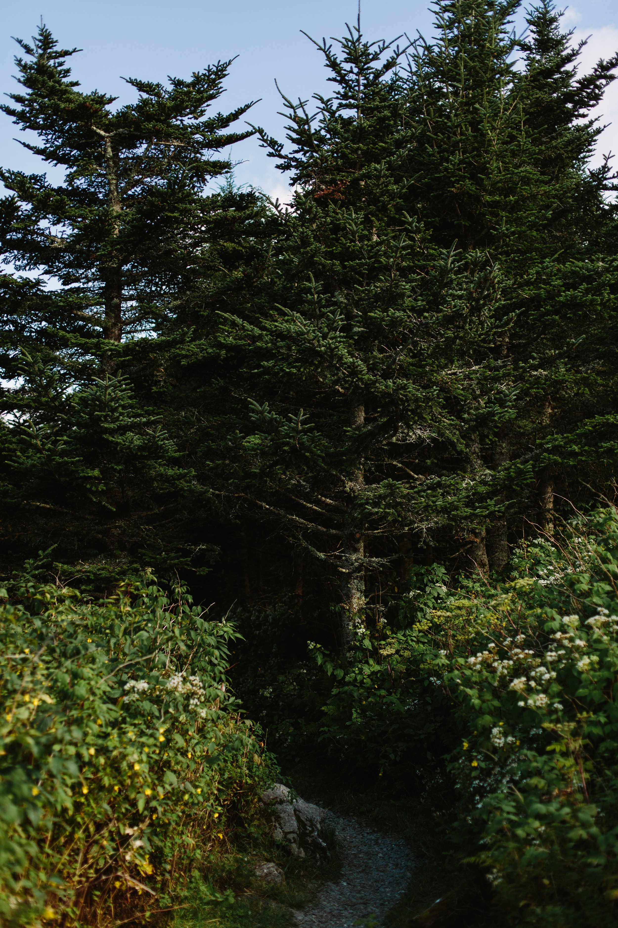
The elevation at the highest levels of the mountain enables a climate that supports a Fraser fir forest, rarity in these latitudes. The trees are coated in mosses, the ground covered in ferns, and the air thick with cool moisture. It feels more like the lush forests of Maine or the Pacific Northwest which is a stark contrast to the heat just a few hundred feet below the peak. The Balsam Nature Trail is a short, easy hike that submerges hikers in this enchanted forest world.


I continued along the parkway to my final waypoint, and one of my favorite locations, — Craggy Gardens. This is one of the most popular spots along the parkway for many reasons. Not only does it have amazing views in multiple directions and from multiple points, but it is also surrounded by acres of dense rhododendrons. These shrubs hug the slopes bordering the parkway and in early summer, the pink and purple blooms are captivating. On this summer day, the flowers long since bloomed, so I simply soaked in the views under the clear blue sky.

Departing my final stop on the parkway that day, I made my way down from the mountains on Route 80. The stretch of road near the intersection with The Blue Ridge Parkway is known as “The Devil’s Whip” because of its quick elevation exchange and multiple curves and switch backs. It’s a fun stretch of road to drive, but not to be a passenger. I always drive it carefully, since it’s a popular route for motorcyclists.
As my summer sojourn came to a close and I merged on the interstate that would take me home, I looked into the rearview mirror and saw a view I will never forget. I actually had to pull over for this one. Exit 94 on I-40 has one of the most incredible views from any highway I’ve seen in the south east. Looking west, the highway ascends slightly and all of the sudden, the peaks of the Blue Ridge Mountains emerge into view, growing ever taller until you pass the exit. It's a point on the highway that always signifies something special to me — I’m either on my way to the mountains or I just came from them, and either way, I know life is good.

*Many of the locations mentioned in this post were disastrously affected by Hurricane Helene in September, 2024. Please do your research when planning a visit to the region. At the time of this publication, many places have reopened for business and are gladly welcoming travelers. However, some businesses and locations are still recovering from the extensive damage. There are still many road closings along The Blue Ridge Parkway. You can visit the Official Blue Ridge Parkway Website for road closure updates. Another great resource is VisitNC.com, where you can find travel updates for the entire state.
Want to see everything in one place?
I’ve mapped out all the must-visit spots, trails, and hidden gems from this guide in an interactive Google Map. Check it out here and start planning your own adventure!

Blue Ridge Parkway Guide
Best Hikes & Overlooks (MM 306-365)
Thanks for reading along. If you’re interested in travel that’s a little less polished, a little less planned, and a lot more focused on the feeling of being in a place, subscribe to Waypoints. Paid subscribers receive an exclusive discount on all prints and products in the shop.
Let's wander a little slower, and see what we find.
Lindsey A. Miller